
If you’ve ever taken a stroll around Wesbrook Place, you’ve likely noticed the many waterways located in-between buildings or in parks.
There are two main systems in Wesbrook Place. The east waterway runs east of Wesbrook Mall, commencing in Khorana Park, flowing into Michael Smith Park, and running through to Wesbrook South until Binning Avenue.
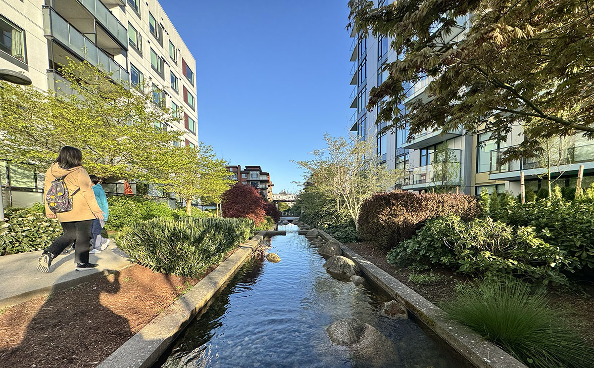
The west waterway originates at Birney Avenue, north of Mundell Park, and continues down Webber Lane, ending in Nobel Park.
The east waterway was built 2009, and the west waterway was completed in 2014. A new section of the west waterway was added between Gray Ave. and Ross Dr. in 2022.
The waterways provide an aesthetic public amenity, but also serve the function of moving rainwater from runoff sources, some stormwater management, and even ecological functions.
Both waterways aid in conveying rooftop and ground runoff of water, especially helping in managing high volumes of rainwater during the region’s winter months.
They also serve as a natural habitat for many native species. During their breeding season, they provide habitat for Pacific Tree Frogs and a temporary resting ground for migratory birds such as Canada Geese, ducks and even the occasional Grey Heron.
For the east waterway, rainwater is conveyed from building rooftops or from the UBC stormwater management system into a park pond just north of Binning Ave. The pond also recharges the Upper and Lower Point Grey aquifers with excess rainwater through sand filtration.
During high rainfall periods, any overflow in the pond and waterway in the east waterway goes into the stormwater management system and Booming Ground Creek, which is located in the southernmost part of Wreck Beach.
In periods with lower rainwater, water is recirculated through the system or, when needed, pumped from the aquifer. Since the water in this system draws from the aquifer, it doesn’t impact other sources, campus officials say.
Similar to the east waterway, the west waterway sources its water from roof runoff of nearby buildings and then recirculated through the system. Any overflow goes back into the storm management system, and in periods with low rainfall, this system is sometimes topped up with potable water, says Wegland Sit, the Operations Manager at the UNA.
The waterways require regular maintenance through inspection and cleaning. They are also monitored to preserve them, especially in the warmer months when higher temperatures promote surplus algae growth. Due to its shallow depth and high organic content, the east waterway is particularly sensitive to algae buildup.
Instead of sending away excess rainwater through underground sewers, these water systems manage excess rainfall and add beauty to the campus neighbourhoods, as well as natural habitat for animals.
AMIE BERNAERDT IS A THIRD YEAR STUDENT AT UBC, MAJORING IN CREATIVE WRITING AND ANTHROPOLOGY. SHE LIVES IN WESBROOK PLACE.